ALTA/NSPS Land Title Surveys Explained for Commercial Buyers
When you purchase or develop commercial property in Montana, one document carries more weight than almost any other: the ALTA/NSPS Land Title Survey.
Lenders, title companies, and investors depend on this survey because it provides the most complete picture of a property’s boundaries, improvements, and potential risks.
At Prairie Point Land Surveyor, we prepare ALTA/NSPS surveys that meet national standards and support smooth, confident transactions. If you’re buying, refinancing, or developing commercial land, here’s what this survey includes — and why your project depends on it.
What an ALTA/NSPS Land Title Survey Is
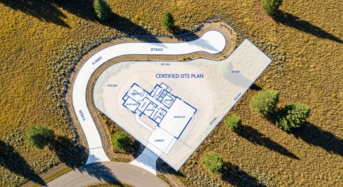
An ALTA/NSPS survey is a detailed, standardized survey developed by the American Land Title Association (ALTA) and the National Society of Professional Surveyors (NSPS).
It goes far beyond a typical boundary survey. The goal is to give all parties — lenders, title insurers, attorneys, and buyers — a complete, accurate view of the property.
This survey verifies:
- The property’s boundary and corner monuments
- Building locations and their distances to boundaries
- Encroachments, easements, access rights, and rights-of-way
- Utilities, visible improvements, and site features
- Zoning classifications and setback requirements (if requested)
- Every detail supports the transfer of clear, insurable title.
Why Commercial Buyers Need an ALTA Survey
Commercial real estate carries higher risk and stricter due diligence requirements than residential property.
Lenders and title companies rely on ALTA standards to confirm that nothing on the property — or just outside of it — could affect ownership, development, or long-term use.
An ALTA survey helps identify:
- Encroachments that may affect expansion
- Easements that limit building placement
- Access restrictions that may affect operations
- Recorded or unrecorded improvements
- Conflicts between field evidence and title documents
Without this level of detail, a project can face unexpected delays, redesigns, or legal complications.
What Makes ALTA Surveys Different From Standard Surveys
While a boundary survey defines the limits of your property, an ALTA survey combines boundary verification with a deeper investigation of title elements.
It ties together field measurements, public records, title commitments, and optional Table A items selected by the client or lender.
These optional items may include:
- Flood zone classification
- Topographic mapping
- Parking counts
- Utility evidence and underground research
- Zoning setback documentation
The ALTA standards ensure that everyone reviewing the property sees the same certified data, prepared to national guidelines.
The Process of Completing an ALTA Survey
We begin by reviewing your title commitment and all recorded documents affecting the property. This includes easements, access agreements, plats, and prior surveys.
In the field, we locate boundary evidence, measure improvements, identify utilities, and document visible encroachments. We verify all measurements using high-precision GPS and total station equipment.
Once fieldwork is complete, we prepare a certified ALTA drawing that includes every required element and any Table A items you or your lender have selected.
Before delivering the final survey, we ensure it meets ALTA/NSPS Minimum Standard Detail Requirements and aligns with Montana’s licensing and documentation regulations.
When to Order an ALTA Survey
You should request an ALTA survey any time you are:
- Purchasing commercial land or buildings
- Seeking financing for commercial property
- Developing a site or expanding an existing facility
- Refinancing a commercial loan
- Resolving title or access questions
Ordering early helps your lender, attorney, and title company review the results before closing, keeping the transaction on schedule.
Benefits for Developers and Investors
An ALTA survey gives you the clarity to make confident decisions. It reveals whether your project meets zoning and setback requirements, whether utilities are adequate for redevelopment, and whether existing improvements align with the recorded title.
It also reduces costly surprises — from hidden easements to unrecorded encroachments — that can disrupt construction or change the design.
For long-term investors, a precise ALTA survey strengthens due diligence and protects the investment from future disputes.
Montana-Specific Considerations
Montana’s mix of urban, industrial, and rural commercial sites creates unique challenges. Older properties may have incomplete records or outdated improvements.
In developing areas, access easements, utility corridors, and floodplain boundaries can shift over time. Our team understands how these factors affect commercial transactions and ensures that every ALTA survey reflects both national standards and local conditions.
Final Thoughts
An ALTA/NSPS Land Title Survey provides the certainty commercial buyers need. With a clear view of boundaries, easements, and improvements, you gain the confidence to close, develop, or invest without unnecessary risk.
At Prairie Point Land Surveyor, we deliver accurate, compliant ALTA surveys that support smooth transactions and long-term property success.
If you’re purchasing or developing commercial property, we can help.
Contact Prairie Point Land Surveyor for a certified ALTA/NSPS Land Title Survey prepared to national standards and Montana requirements.