Decoding Your Survey Plat: Key Symbols and Terms Explained
When you receive a certified survey plat, it can look technical at first glance. Lines, angles, abbreviations, and symbols fill the page. But each element serves a purpose.
Understanding your survey plat helps you make informed decisions about your property — whether you’re building, selling, resolving a boundary question, or reviewing title documents.
At Prairie Point Land Surveyor, we believe survey data should be clear and usable. Here’s how to read the most common symbols and terms on your survey drawing.
What Is a Survey Plat?
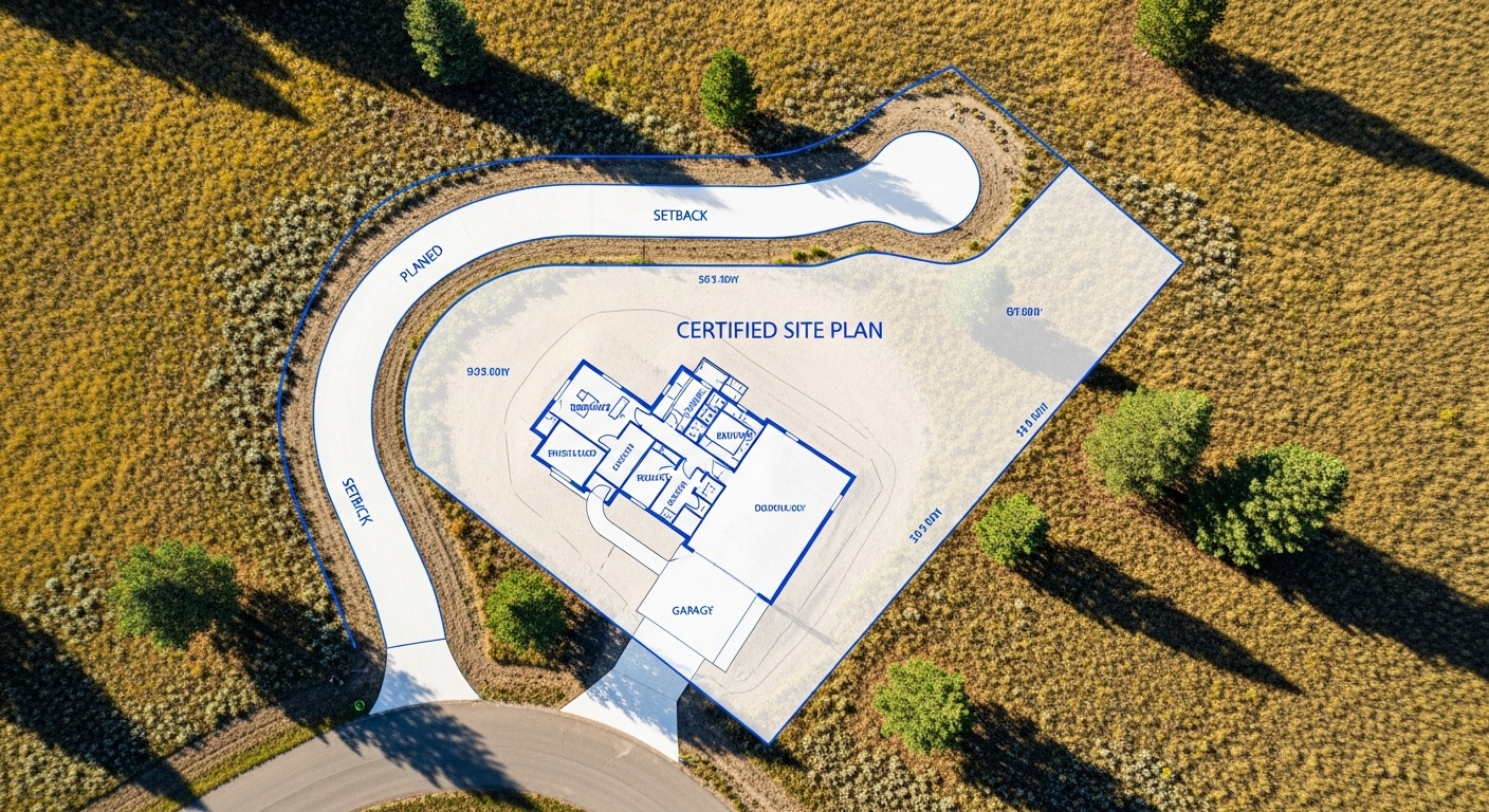
A survey plat (sometimes called a survey map or drawing) is the official, scaled representation of your property based on field measurements and record research.
It shows:
- Boundary lines
- Property corners
- Dimensions and bearings
- Easements and rights-of-way
- Structures and visible improvements
- Notes and certifications
The plat becomes a legal reference document once signed and sealed by a licensed surveyor.
Boundary Lines, Bearings, and Distances
Boundary lines define the legal limits of your property. Along each line, you’ll see a bearing and a distance.
A bearing describes direction, typically expressed relative to north (for example, N 89°45’ E).
A distance indicates the measured length of that line, usually shown in feet.
Together, bearings and distances define the exact shape of your parcel.
Property Corner Symbols
Corners are typically marked with specific symbols that correspond to physical monuments in the ground. Common notations may include:
- Found monument (existing corner located in the field)
- Set monument (new marker placed by the surveyor)
- Iron pin or capped rebar
Each corner symbol on the plat should match an actual monument on the property. If a corner is missing or disturbed, the survey will note how it was reestablished.
Easements and Rights-of-Way
Easements are areas where others have limited rights to use part of your property. On a survey plat, they are often shown with dashed lines or labeled strips along boundaries.
Common examples include:
- Utility easements
- Drainage easements
- Access easements
- Public rights-of-way
These areas may restrict where you can build or place improvements. Reviewing them carefully before construction is essential.
Improvements and Structures
Buildings, garages, driveways, fences, and other visible improvements are typically shown in relation to boundary lines. Measurements may indicate how far structures sit from property lines.
This information helps confirm compliance with local setback requirements and identifies potential encroachments.
Contours and Elevation Notes
On a topographic survey plat, you may see contour lines or spot elevations. Contours show changes in elevation across the land. Close spacing indicates steeper slopes, while wider spacing suggests flatter areas.
Elevation data is especially important for drainage, grading, and construction planning.
Legal Description and Certification
Every certified survey plat includes a legal description of the property and a surveyor’s certification statement.
The certification confirms:
- The survey was performed by a licensed professional
- Measurements meet Montana standards
- Monuments were found or set as required
Always verify that your survey includes the surveyor’s signature and seal. An unsigned drawing is not legally valid.
Why Understanding Your Plat Matters
Your survey plat is more than a technical drawing — it protects your property rights.
When you understand what it shows, you can:
- Confirm boundary locations before building
- Identify easement restrictions
- Support real estate transactions
- Resolve disputes with accurate documentation
Clear interpretation prevents costly mistakes and delays.
Final Thoughts
Survey plats may look complex, but they are designed to communicate clear, precise information about your property. With a basic understanding of key symbols and terms, you can read your survey with confidence.
At Prairie Point Land Surveyor, we prepare certified survey plats that are accurate, compliant, and easy to interpret — so you always know where you stand.
Have questions about your survey plat?
Contact Prairie Point Land Surveyor for clarification or to request a certified boundary or topographic survey in Montana.