Boundary vs. Topographic Surveys: What’s the Difference?
If you’re planning a construction project, buying property, or preparing for permitting, you’ve likely heard the terms boundary survey and topographic survey. While they’re both essential tools, they serve very different purposes — and choosing the right one can save time, money, and frustration.
At Prairie Point Land Surveyor, we help Montana property owners understand exactly which survey they need and why. Here’s a clear breakdown of the differences between boundary and topographic surveys, and when each one matters most.
What a Boundary Survey Does
A boundary survey defines the legal limits of your property. It answers one fundamental question: Where does my land begin and end?
To do this, a licensed surveyor researches deeds, plats, and public records, then locates or sets property corner monuments in the field. The resulting certified drawing shows boundary lines, bearings, distances, and any encroachments or overlaps with neighboring parcels.
Boundary surveys are commonly used for:
- Confirming property corners
- Resolving boundary disputes
- Building fences or structures near property lines
- Buying or selling land
- Legal documentation and title review
If ownership limits or property rights are your primary concern, a boundary survey is essential.
What a Topographic Survey Does
A topographic survey focuses on the physical features of the land rather than legal boundaries. It shows how the ground rises and falls and documents visible site features such as buildings, driveways, trees, utilities, and drainage paths.
Topographic surveys include contour lines and spot elevations that engineers and designers use to plan grading, drainage, foundations, and access. While boundaries may be shown for reference, the primary purpose is to understand the terrain.
Topographic surveys are typically used for:
- Site and grading design
- Drainage and stormwater planning
- Roadway and utility projects
- Construction layout and engineering
- Landscape architecture
If your project depends on elevation or slope, a topo survey is the right tool.
Key Differences at a Glance
The main difference between these surveys lies in what they measure. A boundary survey measures legal property limits. A topographic survey measures the shape and features of the land.
A boundary survey answers ownership questions. A topo survey answers design and construction questions. Many projects require one or the other — and some require both.
When You Might Need Both
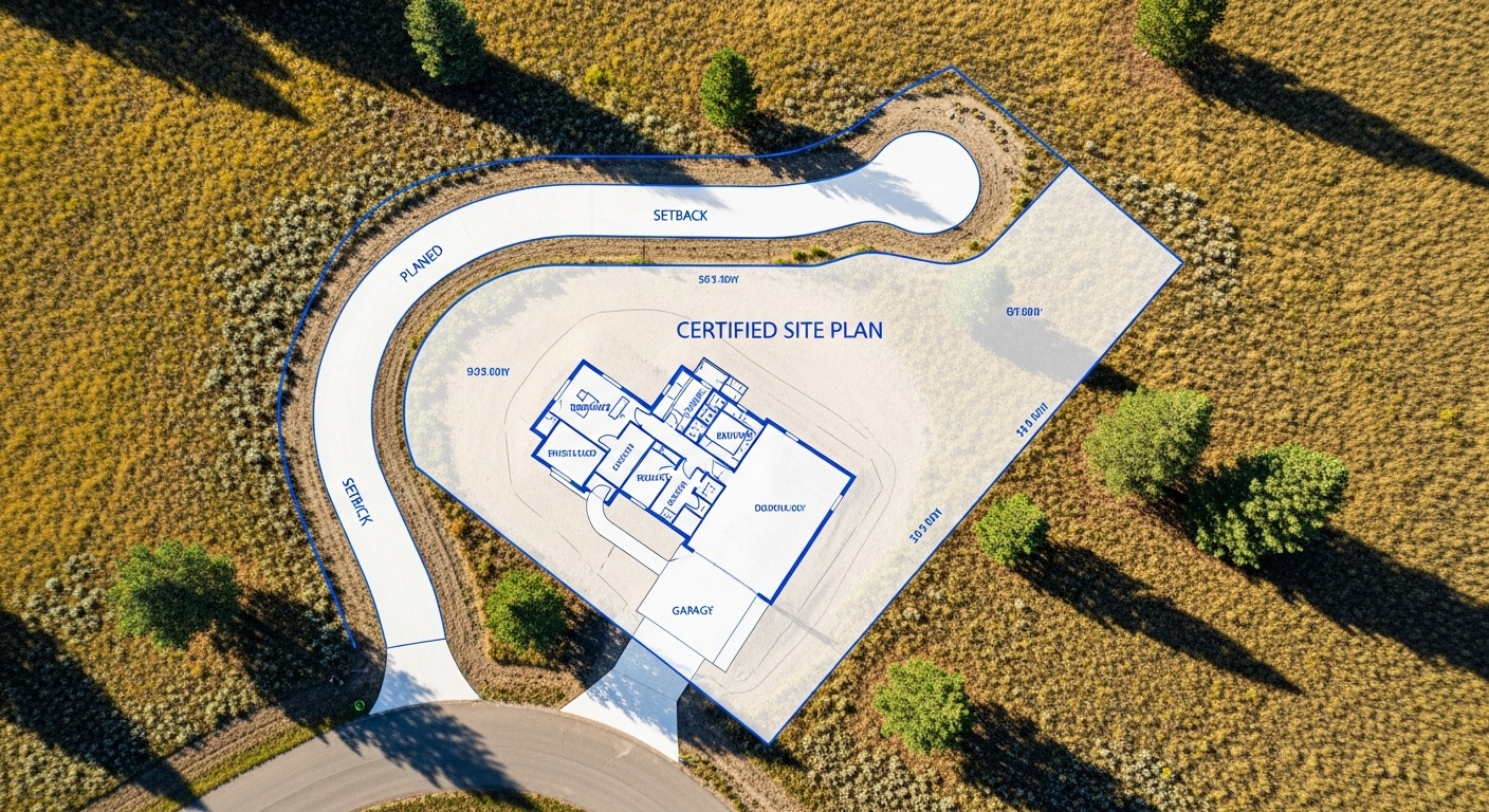
In many cases, a project benefits from combining boundary and topographic data. For example, when designing a new home or commercial building, engineers need accurate elevations, and permitting offices need verified setbacks from property lines.
By completing both surveys together, you ensure:
- Designs are based on accurate boundary limits
- Structures meet zoning and setback requirements
- Drainage and grading plans align with legal constraints
- Permitting reviews proceed smoothly
Prairie Point can prepare a combined boundary and topographic survey to support the full scope of your project.
Montana-Specific Considerations
Montana properties often include large parcels, irregular boundaries, and variable terrain. Rural sites may require extensive boundary research, while sloped or flood-prone areas demand precise elevation data.
Local jurisdictions may also require specific survey information for permits or approvals. Working with a Montana-based, licensed surveyor ensures your survey meets both technical and regulatory expectations.
Choosing the Right Survey for Your Project
The best way to choose the right survey is to start with your goal. If you need to confirm ownership or mark corners, a boundary survey is required. If you’re planning design, grading, or construction, a topographic survey is likely needed.
If you’re unsure, a professional surveyor can review your project plans and recommend the appropriate scope — helping you avoid unnecessary work while ensuring compliance.
Final Thoughts
Boundary and topographic surveys serve different purposes, but both play a critical role in successful land projects. Understanding the difference helps you make informed decisions and keeps your project moving forward.
At Prairie Point Land Surveyor, we provide clear guidance and accurate survey data — so you get exactly what you need, when you need it.
Not sure which survey your project requires?
Contact Prairie Point Land Surveyor to discuss your goals and receive a clear recommendation from a licensed Montana surveyor.