What to Include in Your 2026 Development Checklist
Successful development projects rarely happen by accident. They’re planned months in advance, with the right documentation in place before design or construction begins. As the year winds down, now is the ideal time to prepare a development checklist that sets your 2026 project up for success.
At Prairie Point Land Surveyor, we work with homeowners, developers, and commercial clients across Montana who want to avoid delays, redesigns, and permitting issues. Here are the key survey-related items every development checklist should include before the new year begins.
Start With Boundary Verification
Every project begins with knowing exactly what you own. A boundary survey confirms property lines, corner monuments, and any potential encroachments. This step is essential before design work starts, especially if structures, parking areas, or access roads will be built near property lines.
Boundary verification early in the process helps prevent conflicts with neighboring parcels and ensures your project footprint stays within legal limits.
Confirm Easements and Access
Recorded easements can significantly affect how a site can be developed. Utility corridors, shared driveways, drainage easements, and access agreements should all be identified and reviewed early.
A survey that clearly shows easements allows your design team to work around restrictions instead of discovering conflicts during permitting or construction. This step is particularly important for commercial and multi-lot projects.
Include a Topographic Survey
If your project involves grading, drainage, or foundation design, a topographic survey should be high on your checklist. Accurate elevation data supports engineering decisions and helps ensure compliance with stormwater and slope requirements.
Topographic surveys also help identify potential challenges early, such as drainage paths, low areas, or steep slopes that may affect design or construction costs.
Address Floodplain and Elevation Requirements
For properties near rivers, creeks, or low-lying areas, floodplain considerations are critical. Determining whether your site falls within a FEMA-mapped flood zone — and whether an Elevation Certificate is required — should happen well before permitting.
Having elevation data ready allows engineers and planners to design appropriately and helps avoid last-minute changes requested by permitting agencies or lenders.
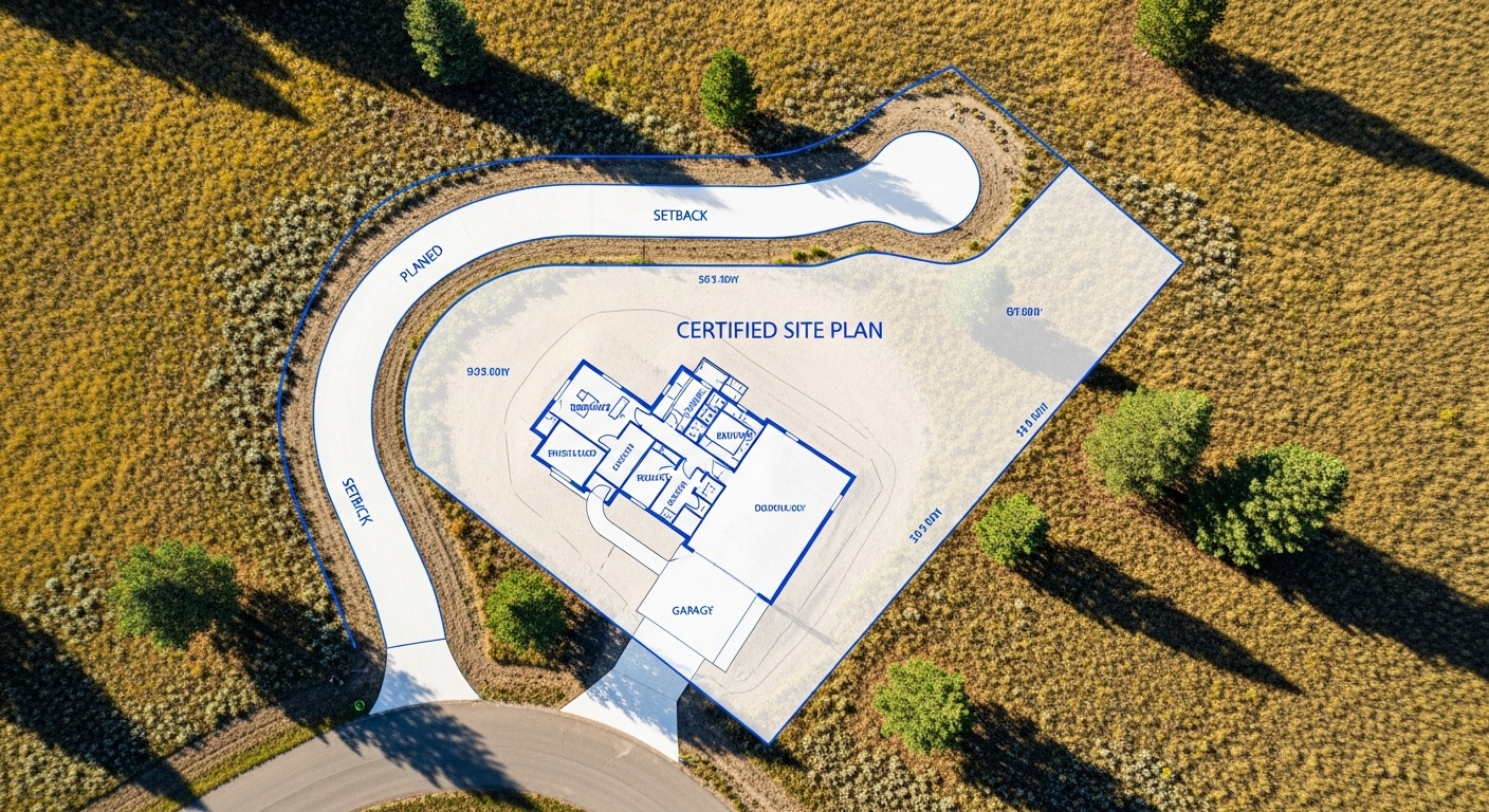
Plan for Permitting and Site Plans
Most jurisdictions in Montana require a certified site plan as part of the permit application. This plan shows proposed structures, setbacks, access points, and existing site features in relation to verified boundaries.
Including site plan preparation in your checklist ensures permitting can proceed smoothly once design details are finalized. It also gives contractors a reliable reference before construction begins.
Consider ALTA/NSPS Surveys for Commercial Projects
If your project involves commercial property, refinancing, or outside investment, an ALTA/NSPS Land Title Survey may be required. These surveys provide a comprehensive view of boundaries, easements, improvements, and access — supporting due diligence and lender review.
Ordering an ALTA survey early helps keep transactions and development schedules aligned.
Review Local and County Requirements
Montana development standards vary by county and municipality. Setbacks, access rules, drainage requirements, and recording procedures may differ depending on location.
Working with a local surveyor who understands these jurisdiction-specific requirements helps ensure your documentation aligns with local expectations from the start.
Why Early Planning Pays Off
Including survey work in your development checklist early saves time and money. Accurate survey data allows architects, engineers, and contractors to work efficiently, reduces redesigns, and minimizes permitting delays.
By preparing now, you enter the new year with verified data, clear boundaries, and a defined path forward — rather than waiting on surveys once construction season begins.
Final Thoughts
A strong development checklist turns good ideas into successful projects. By addressing boundaries, topography, access, and permitting requirements early, you reduce risk and keep your timeline on track.
At Prairie Point Land Surveyor, we help Montana property owners and developers prepare with accurate, compliant survey data — so projects move forward with confidence.
Planning a development or construction project in 2026?
Contact Prairie Point Land Surveyor to schedule boundary, topographic, site plan, or ALTA survey services and start the year prepared.