ALTA Surveys: Your Key to Stress-Free Commercial Deals in Billings

June 26, 2025

Hello, Billings developers and business owners! If you’re buying or financing commercial property in Yellowstone County, you’ve likely heard about ALTA surveys. These specialized surveys are essential for smooth real estate transactions, and at Prairie Point Land Surveyor, we’re here to make them straightforward for you. Let’s explore what an ALTA survey is and why it’s critical for your commercial projects in Billings, MT. 


What Is an ALTA Survey? 


An ALTA/NSPS survey is a detailed property survey that meets strict standards set by the American Land Title Association (ALTA) and the National Society of Professional Surveyors (NSPS). It’s like a comprehensive blueprint of your property, showing boundaries, buildings, easements, utilities, and potential issues. In Billings, where commercial developments are on the rise in areas like the West End, an ALTA survey is often required by lenders, title companies, and attorneys to ensure a clean transaction. It’s the gold standard for commercial real estate deals. 


Why Billings Businesses Need ALTA Surveys 


Billings’ commercial market is growing, from new office spaces downtown to developments near Lockwood. Here’s why an ALTA survey is a must: 


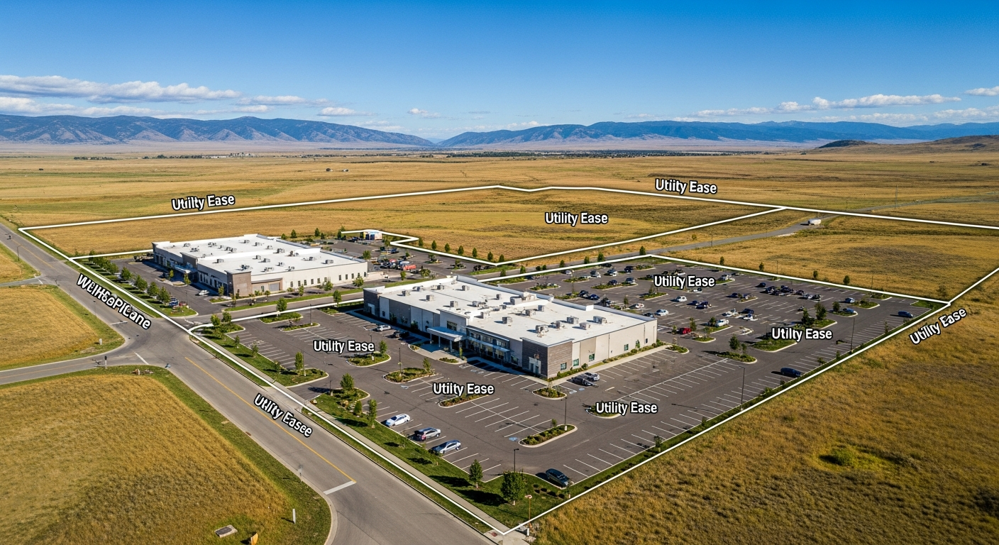
Protect Your Investment: An ALTA survey uncovers issues like encroachments or easements that could derail your deal. For example, we’ve helped clients spot utility easements on properties near Billings Heights before closing. 

Meet Lender Requirements: Most banks and title companies in Yellowstone County require an ALTA survey to confirm the property meets their standards, reducing risks for financing. 

Ensure Compliance: Billings has specific zoning and land use rules. An ALTA survey ensures your project aligns with local regulations, avoiding costly delays. 

Provide Clarity: With detailed maps and reports, an ALTA survey gives all parties—buyers, sellers, and lenders—confidence in the transaction. 


Without an ALTA survey, you risk unexpected complications that could cost thousands to fix. 


How Prairie Point Delivers Top ALTA Surveys 


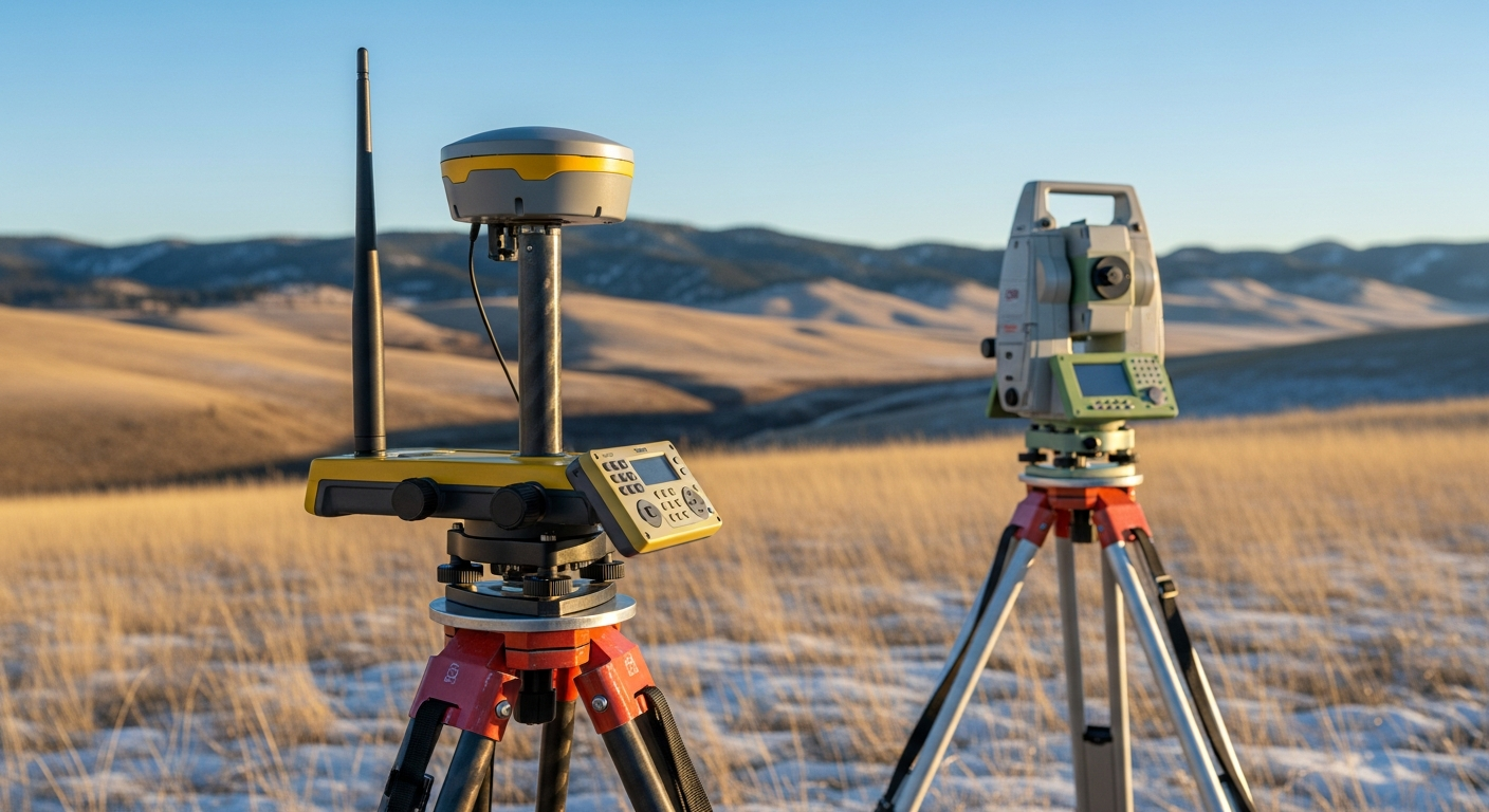
At Prairie Point Land Surveyor, we’re your local experts in Billings, MT, with a deep understanding of Yellowstone County’s commercial landscape. Our licensed team uses advanced GPS technology to produce precise ALTA/NSPS surveys tailored to your needs. We work closely with title companies and attorneys to meet all requirements, whether for a retail space downtown or a larger project near Shepherd. Our clear communication and commitment to accuracy mean you get a reliable survey without the hassle. 


Call Prairie Point for Your ALTA Survey Quote 


Don’t let your commercial deal in Billings hit a snag. Trust Prairie Point Land Surveyor for a thorough ALTA survey that keeps your project on track. Call us at 406-551-1916 for a free quote today, or visit prairiepointlandsurveyor.com to learn more about our ALTA/NSPS surveys and other services. Let’s make your next commercial venture in Yellowstone County a success! 

Aerial view of a house plan overlaid on a dirt lot, showing a curved driveway and surrounding trees.
November 19, 2025
Get a certified site plan that meets Montana permitting standards. Learn how accurate survey data supports zoning compliance, construction planning, and smooth permit approval.
Fence lines across a dry field, mountains in the distance under a blue sky.
November 12, 2025
Understand Montana’s surveying laws and why only licensed surveyors can certify property boundaries. Learn how compliant surveys protect ownership and ensure legal accuracy.
Surveyors' stakes and lines mark a grassy field, mountains in the distance, and blue sky.
November 5, 2025
Learn how to read a land survey drawing with confidence. Understand boundaries, easements, and topography from certified Montana surveyors.
Surveying equipment set up by a river, autumn landscape.
October 30, 2025
Get clarity on elevation certificates in Montana. Learn how certified data from a licensed land surveyor can lower flood insurance costs and ensure FEMA compliance.
October 24, 2025
Before winter weather settles across Montana, it’s worth asking: Are your property boundaries clearly defined? At Prairie Point Land Surveyor, we see a consistent pattern each year. Homeowners and developers who schedule surveys in the fall avoid costly construction delays, permit issues, and frozen-ground headaches once winter arrives. Here’s why autumn is the ideal season to complete a boundary survey —and how it helps you move confidently into the new year. Why Boundary Surveys Matter A boundary survey identifies and verifies the exact limits of your property. It’s the foundation for nearly every land-related decision, from installing a fence to subdividing acreage. The surveyor’s job is to locate property corners, research deeds and plats, and produce a certified survey drawing you can rely on for permits, design, or construction. Without an accurate survey, you risk building in the wrong location or misjudging your property’s size—and that can lead to legal disputes, wasted material, and project delays. Fall Offers the Best Field Conditions In Montana, field conditions matter. Surveying depends on visibility, accessibility, and stable ground—all of which are optimal during the fall months. 1. Better Ground Visibility By late September and October, vegetation starts to thin out. This improves line-of-sight for instruments and makes corner markers, fences, and monuments easier to locate. Tall grass, dense brush, and summer foliage often obstruct boundary points—so survey accuracy improves when sightlines are clear. 2. Accessible Terrain Before winter snowpack or spring runoff, surveyors can reach corner monuments without the added challenge of mud or ice. Dry, stable soil allows for faster and safer surveying work. 3. Ideal Lighting and Weather Cooler temperatures mean crews can spend longer periods in the field, and with less heat distortion affecting instrument readings, the precision of total station and GPS measurements is often at its peak. Avoid Winter Delays and Frozen Ground Once Montana’s frost sets in, fieldwork becomes more complex. Iron pins and monuments can freeze in place, snow can obscure markers, and the ground may require thawing before measurement or excavation. Surveying ahead of the cold season ensures your survey record and certified map are complete and ready when contractors, lenders, or county offices need them. In other words: while others wait for spring thaw, you’re ready to move forward. Perfect Timing for Upcoming Projects Whether you’re planning a fence installation, driveway, addition, or new build in the coming year, a fall survey keeps your project timeline on track. You’ll benefit from: Accurate site data for design and permitting. Your engineer or architect can begin work immediately. Verified property corners for contractors. Builders can plan without uncertainty. Regulatory compliance early on. If you need an Elevation Certificate or ALTA/NSPS Land Title Survey , completing it before winter avoids spring rush delays. By scheduling now, you’ll enter construction season with confidence—and likely save on costs tied to rushed or postponed surveys. Legal & Real Estate Advantages Boundary clarity doesn’t just support construction—it protects ownership. A current survey helps confirm legal property lines , identify encroachments , and resolve title questions before a sale or refinance. Lenders and title companies frequently require an updated boundary or ALTA/NSPS Land Title Survey before closing. Having this documentation ready in advance helps your transaction move smoothly, even during the busy spring market. How Prairie Point Handles Fall Surveys At Prairie Point Land Surveyor , we combine detailed field measurements with local regulatory expertise. Every survey is conducted by a licensed Montana surveyor , and each certified drawing meets state and county requirements. Our process includes: Record Research – Reviewing deeds, plats, and easements. Field Work – Locating or setting property corners using GPS and total station equipment. Data Analysis – Reconciling field findings with record documents. Certified Survey Drawing – Delivering a clear, precise map ready for permitting, sale, or construction. You receive a final deliverable you can trust—accurate, compliant, and ready for your next step. Montana-Specific Considerations Local conditions make Montana surveying unique. From expansive rural tracts to complex subdivision corners, each site demands local experience and familiarity with county records. Our Billings-based team understands these conditions—whether your property lies in Yellowstone County or along the surrounding rural edges—and ensures compliance with state and local surveying standards . When to Schedule Your Fall Survey We recommend booking a boundary or elevation survey between mid-September and mid-November , before the first deep freeze. If you’re planning construction, land purchase, or design work in spring 2026, now is the right time to: Confirm property boundaries Obtain a certified survey drawing Request elevation data or ALTA documentation Scheduling early ensures availability and avoids the spring backlog. Final Thoughts Fall offers the perfect window to clarify your property boundaries before Montana’s winter sets in. Accurate survey data now saves time, prevents disputes, and prepares you for any project or transaction ahead. At Prairie Point Land Surveyor, we provide precise, compliant, and dependable results—so you can move forward with confidence, whatever your next project may be. Need a boundary survey before winter? Contact Prairie Point Land Surveyor today for a quote and timeline. You’ll receive a certified survey drawing that meets all regulatory standards and keeps your plans on solid ground.
September 10, 2025
Learn how easements can impact your property rights in Montana. From utility lines to shared driveways, discover why a land survey is essential before you build or buy in Billings.
Aerial view of a rural landscape with fields of green and gold, trees, roads, and a distant mountain range under a blue sky.
September 3, 2025
Thinking about subdividing your property in Montana? Learn how a land surveyor helps ensure legal, accurate, and efficient land splits—especially in growing areas like Billings and Yellowstone County.
July 17, 2025
Most property owners don’t think about land surveying until a problem arises. Whether you’re purchasing land, building on your lot, or facing a dispute, a land surveyor plays a crucial role in protecting your property rights. In a growing state like Montana—especially around busy markets like Billings—land use is becoming more complex. In this post, we’ll highlight the top 5 reasons you might need a land surveyor and how it can save you time, money, and legal headaches down the road. 1. You’re Buying Property in Montana Before closing on any real estate transaction, it’s smart to confirm exactly what you’re purchasing. A land surveyor can verify the boundaries, easements, and dimensions of the property—and check if any structures encroach on neighboring land. Without a survey, you may unknowingly inherit: - A neighbor’s shed or fence on your lot - Inaccurate lot dimensions - Hidden access easements or utility lines In Billings, where property development is expanding into previously rural areas, these issues are increasingly common. A survey protects both buyers and sellers by ensuring the land matches what’s promised in the deed. 2. You’re Building a Fence, Garage, or Home Addition Thinking about building a new fence or garage? You’ll want to know your exact property lines. Montana law doesn’t require you to get a survey before building—but skipping it can lead to serious issues later. If a structure crosses into a neighbor’s property, you could be forced to move or remove it. Surveys ensure your improvements are legal and help you avoid expensive disputes. In Billings neighborhoods like the Heights or West End, where parcels are tightly packed, a few inches can make all the difference. 3. You’re Dealing with a Property Line Dispute Few things sour neighborly relations faster than a disagreement over boundaries. Whether it’s about a shared driveway, a tree, or a misplaced fence, these issues often boil down to unclear or inaccurate property lines. A licensed land surveyor provides objective, legally recognized evidence of where your land begins and ends. In many Montana courts, a professional boundary survey is key to resolving disputes quickly and fairly. 4. You’re Subdividing or Developing Land If you’re turning one parcel into two (or more), you’ll absolutely need a survey. Land surveyors play a vital role in: - Mapping new lot lines - Meeting Yellowstone County subdivision requirements - Providing data for zoning and development approval For developers and landowners looking to build in the Billings area, working with a surveyor early in the process keeps things running smoothly and helps avoid rework or permitting delays. 5. You Need to Comply With Zoning, Permits, or Legal Descriptions Montana municipalities—including Billings—have specific setback rules, zoning laws, and right-of-way regulations. These can affect where you’re allowed to build, how close you can build to a street or neighbor, and what kind of improvements are allowed. A surveyor ensures that your property’s legal description matches reality—and that you’re in compliance with all local requirements. This is especially important if you're applying for permits or refinancing through a lender. Bonus Reason: Peace of Mind Even if none of the above applies to you right now, a professional land survey gives you clarity and confidence. You’ll know: - Where your property starts and ends - That you're in compliance with local laws - That you’ve taken the right steps to protect your investment For rural properties, historic parcels, or undeveloped land, a survey can reveal surprising (and valuable) information. When in Doubt, Survey It Out A land survey might not be the first thing on your to-do list, but it should be. Especially here in Montana, where vast landscapes meet growing urban sprawl, clearly defined boundaries are more important than ever. Call us at  406-551-1916  for a free quote today, or visit prairiepointlandsurveyor.com to learn more about our services. Let’s ensure your next project in Billings succeeds!
July 10, 2025
Understanding Boundary Surveys in Billings, MT If you're buying property, building a fence, or planning a home addition in Billings, Montana, one of the most critical first steps is getting a boundary survey. Yet, many homeowners and landowners overlook this essential step—only to encounter costly disputes or legal challenges later. In this post, we’ll explain what a boundary survey is, why it’s vital in Yellowstone County, and how it helps you protect your investment. What Is a Boundary Survey? A boundary survey is a detailed process that defines the legal boundaries of a parcel of land. Licensed land surveyors use historical records, deeds, and specialized equipment to determine exactly where your property begins and ends. The final result is often a map (called a “plat”) showing your lot's dimensions, corners, and any existing structures or improvements. Survey markers—such as metal stakes or pins—are typically placed at key points along the boundary for easy reference. Why Boundary Surveys Matter in Billings, MT Here in Billings, property lines aren’t always as clear as they appear. Between decades-old fences, shifting subdivisions, and Montana’s mix of urban and rural land, it’s easy for neighbors to assume the wrong lines. Here are just a few reasons boundary surveys are important: ✅ Prevent Property Disputes Encroachments—like a shed, driveway, or fence crossing a boundary—can lead to legal trouble. A survey ensures that what’s yours is clearly defined, and what’s not is easily addressed before conflicts arise. ✅ Comply with Local Regulations Planning a build? The City of Billings enforces setback requirements and zoning laws that depend on your lot’s exact dimensions. A survey helps you stay compliant and avoid permitting delays. ✅ Aid in Buying or Selling Property Real estate transactions often require accurate land measurements. Whether you're the buyer wanting peace of mind or the seller looking to avoid surprises at closing, a boundary survey is your best insurance. ✅ Support Land Improvements Installing a fence, building an addition, or dividing your lot? You’ll need a survey to make sure improvements don’t accidentally cross into your neighbor’s yard—or violate local codes. How the Boundary Survey Process Works Research: The surveyor pulls legal records, deeds, and subdivision plats from the Yellowstone County Clerk and Recorder’s office or GIS mapping systems. Fieldwork: Using modern equipment like GPS and robotic total stations, the surveyor visits the property to measure existing markers, features, and improvements. Mapping: A professional plat or report is created, showing all boundary lines, dimensions, and permanent markers placed on the ground. Delivery: The completed survey is provided to the property owner and can be filed with the county or used for building permits, legal filings, or disputes. When to Get a Boundary Survey in Billings We recommend a boundary survey any time you: Buy or sell real estate Build a fence or wall Construct a garage, shed, or home addition Subdivide or merge lots Suspect a boundary dispute with a neighbor Apply for zoning changes or land use permits Common Boundary Issues Found in Billings Some typical surprises that surveys uncover in our region include: Fences or buildings over the line (sometimes by several feet) Discrepancies between deeded and actual measurements Overlapping easements or right-of-ways Gaps between adjacent parcels (commonly known as "gores") Unrecorded lot splits or missing corner markers Final Thoughts Whether you own a modest home in Heights or a large acreage south of town, a boundary survey brings confidence, clarity, and legal security. Don’t leave your property lines to chance—get the measurements that matter. Call us at 406-551-1916 for a free quote today to learn more about our services. Let’s ensure your next project in Billings succeeds!
July 2, 2025
Hello, Yellowstone County residents! If you own property or are planning a project in Billings or beyond, hiring a land surveyor can make all the difference. At Prairie Point Land Surveyor, we’re dedicated to helping you protect your investment and avoid costly errors. Let’s dive into the top five reasons a land surveyor is a smart choice for your property in Billings, MT. Why a Land Surveyor Is Essential A land surveyor provides the foundation for any property-related decision, ensuring accuracy and peace of mind. In Yellowstone County, where terrain and regulations can vary widely, a professional survey can prevent misunderstandings and legal issues. Whether you’re in Billings or a rural area like Shepherd, our expertise ensures your project starts on solid ground. Top 5 Reasons to Hire a Land Surveyor Here are the key benefits of working with a land surveyor: Avoid Costly Property Mistakes: Misjudging boundaries or missing easements can lead to expensive fixes. A survey from Prairie Point catches these early. Know Your Land Inside and Out: Understand your property’s features, from slopes in Lockwood to flood zones near the Yellowstone River, with a topographic or elevation survey. Resolve Boundary Disputes: Clear property lines prevent conflicts with neighbors, a common concern in growing areas like the Heights. Ensure Compliance with Regulations: Billings’ zoning laws require accurate surveys for permits and development. We keep you compliant. Boost Property Value: A detailed survey can enhance your property’s marketability for sales or loans. Why Trust Prairie Point At Prairie Point Land Surveyor, we bring local knowledge and advanced technology to every job in Yellowstone County. Our licensed team uses GPS to deliver precise boundary, topographic, and ALTA surveys, tailored to your needs. We’re committed to transparent pricing and clear communication, ensuring you feel confident every step of the way. Call Prairie Point for a Free Quote Ready to safeguard your Yellowstone County property? Contact Prairie Point Land Surveyor for expert guidance. Call us at 406-551-1916 for a free quote today, or visit prairiepointlandsurveyor.com to learn more about our services. Let’s ensure your next project in Billings succeeds!